

How 3D Laser Scanning Technology Is Revolutionizing Building Renovation Projects
 Team Experts
15 October 2026 1:13 am
.
8 min read
Plenty of renovation projects run over budget before the first wall comes down. Such overruns, however, don’t necessarily reflect the quality of the design itself. Sometimes, they’re more indicative of an error in the survey — a misreading of what is actually standing on site, and therefore, what the design should have been drawn against.
For example, a well-conceived office conversion may be designed from drawings that are thirty years old and three fit-outs out of date. The slab that was meant to be level dips two inches across the bay. The column grid drifts off its lines. A duct the plans placed neatly in the ceiling void turns out to hang eight inches lower, right where the new beam was meant to go. The design was strong, but it was being measured against the wrong building. So, if you’re thinking about a renovation this year, before commissioning a single drawing, consider how 3D laser scanning captures what’s already there — and what that changes about every decision that follows — at length.
A scan-led renovation tends to move through four stages. Capture is about recording the building as it truly is, whereas modeling turns that raw record into something a design team can draw from. Coordination is its own stage, testing the new scheme against the old structure, and preservation keeps the record useful long after handover. Where scanning sits across these is partly about where it saves money. It’s also a question you’re going to be answering on every project regardless: how much of this building do you actually know?
It also shapes how the project gets talked about, with clients, contractors and the authorities who sign off on it. The survey you commission is the first line of the story, and it’s one that every consultant after you will read. A scan travels into each drawing, bid and submittal that follows, and it travels as accurate as you captured it. So the choice is less like ordering a measured survey than deciding what the rest of the project will be allowed to assume — for the contractor pricing the work, and for the engineer signing off on it.
What a Laser Scanner Actually Captures
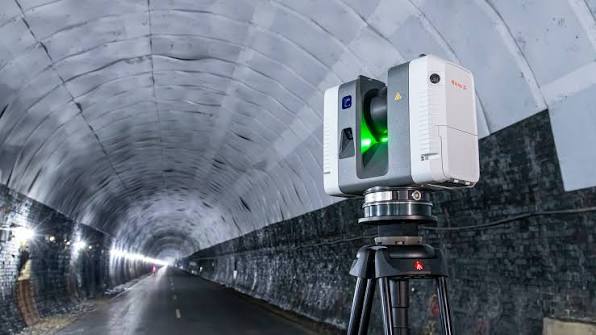
At its core, the technology is about measuring, and a terrestrial laser scanner does that in the plainest terms possible. It fires a pulse of light, times how long that pulse takes to come back, and repeats the process hundreds of thousands of times a second while it turns on its tripod. Every return becomes a single point with an exact position in space. Stitch a few dozen setups together — each one typically takes only a few minutes — and you have a point cloud: a dense, measurable portrait of every surface the laser could see.
Accuracy is the headline. Survey-grade scanners typically hold to within a few millimeters at working range, which beats what a tape measure manages across a long room, and beats it by a wider margin around a curved stair or a vaulted ceiling. Most units photograph the space as they scan, so the cloud comes back in color, and a design team can click through a building it never has to revisit. Handheld and drone-mounted units trade some of that precision for speed, which suits roofs, plant rooms and sprawling sites, and many teams use both.
Drawings That Start From the Truth
Renovation has always had a documentation problem. Original drawings show a building as it was intended, not as it was built, and decades of repairs, partition changes and quiet improvisation widen the gap every year. A site visit with a tape records what the person holding it thought to measure. A scan records everything within the line of sight, including the things nobody thought to ask about. That gap is where a lot of renovation budgets quietly go missing.
The practical shift is where the surprises land. A discovery made in the design phase costs a revised drawing. The same discovery made after demolition costs crew time, a stalled schedule and, more often than anyone budgets for, a change order. Scanning pulls the unknowns forward, to the point where they’re cheapest to fix. For many teams, that’s the difference between a renovation that holds its price and one that doesn’t.
From Point Cloud to Building Model
A point cloud isn’t a drawing. It’s millions of coordinates with no opinion about what any of them are, and someone has to interpret them into walls, slabs, openings and pipework. That interpretation is scan-to-BIM: modelers trace the cloud inside software such as Revit or ArchiCAD, producing an intelligent model the architect can design directly on top of. Deviation analysis goes a step further, coloring the cloud by how far surfaces stray from true, so a floor that falls two inches across a room, or a wall that leans out of plumb, shows up at a glance.
Not every element needs the same effort, and that’s where a good brief earns its keep. A plaster cornice that will be restored needs far more detail than a back-of-house partition that’s coming out next week. Teams that set the level of detail element by element spend their modeling hours where the design needs them, rather than on tracing everything equally.
Coordination Before Demolition
Once the existing building lives in the same digital space as the new design, clashes become visible before anyone is on site. New ductwork is routed against the real structure rather than the assumed one. A steel beam is checked against the real column it lands on. Overlaying the proposed model on the cloud turns the question of whether something will fit from an argument on site into a check at a desk.
It also opens the door to prefabrication, which is where retrofit work has traditionally struggled. Façade panels, ductwork and steel can be fabricated off site to the building’s as-built geometry rather than its drawn geometry, and arrive ready to install instead of ready to be cut down. The tighter the tolerance, the more this matters: a new floor added to an old frame has little room for guesswork.
Heritage Buildings and Adaptive Reuse
Nowhere is the technology more welcome than on buildings that resist the tape. Historic masonry has few straight lines, and old timber frames settle into shapes no original drawing ever described. A scanner records all of it without touching a surface, which matters when the surface is fragile. When art historian Andrew Tallon scanned Notre-Dame de Paris in 2010, he captured more than a billion points of the cathedral; after the 2019 fire, that dataset became a reference for the people planning its reconstruction.
Adaptive reuse leans on the same strengths. Converting a warehouse, a mill or a mid-century office into housing means working with floor heights that don’t repeat and structure that wasn’t drawn for the use now proposed. A scan hands the designer the building as a fixed, measurable fact, and that’s a far better place to start than an old drawing set and a hope. Repeat scans months apart can also show whether a structure is moving, which is useful when a client needs to know that before committing.
Scanning isn’t magic, and it’s worth being clear about what it can’t do. A laser sees only what it has line of sight to, so ceiling voids, wall cavities and anything behind finishes stay hidden unless someone opens them up or brings in ground-penetrating radar or inspection probes. Glass, mirrors and very dark or glossy surfaces can scatter the beam and leave holes in the cloud. And on a small, simple job, a laser distance meter may still be the more sensible tool.
Then there’s the deliverable. Ask for the registered point cloud in an open format such as E57, not just the model derived from it, so the data can be reused if the scope changes. Ask for a stated tolerance. The U.S. Institute of Building Documentation publishes a Level of Accuracy specification for exactly this, and without a number attached, “accurate” means whatever the vendor says it does. With scans easily running to many gigabytes, it’s worth settling storage and ownership before anyone mobilizes.
One More, if the Building Outlives the Project
A fair number of owners don’t stop at the renovation. A scan taken at the start becomes a baseline, and the model built from it can carry into facility management as a digital twin: geometry, systems and maintenance history in one place. Scan again at handover and you have a verified record of what was actually built, which most buildings never get — and which the next renovation team will be glad to find.
None of this replaces design judgment. A scan can tell you exactly where the wall is; it can’t tell you whether the wall should stay. But it does clear away the guessing, so the hours a team spends go to the idea rather than to the argument about what’s there.